
Caminito del Rey that is the King's Road - the main goal of our Marc trip to the south of Spain.
This page is divided into three parts:
- In the first part, there will be some history and archival photos
- W the second you can see the film from our trip
- If you prefer to read instead of watching - the third part is for you
Let's get started!
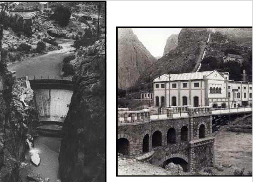
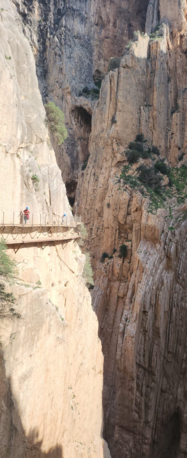
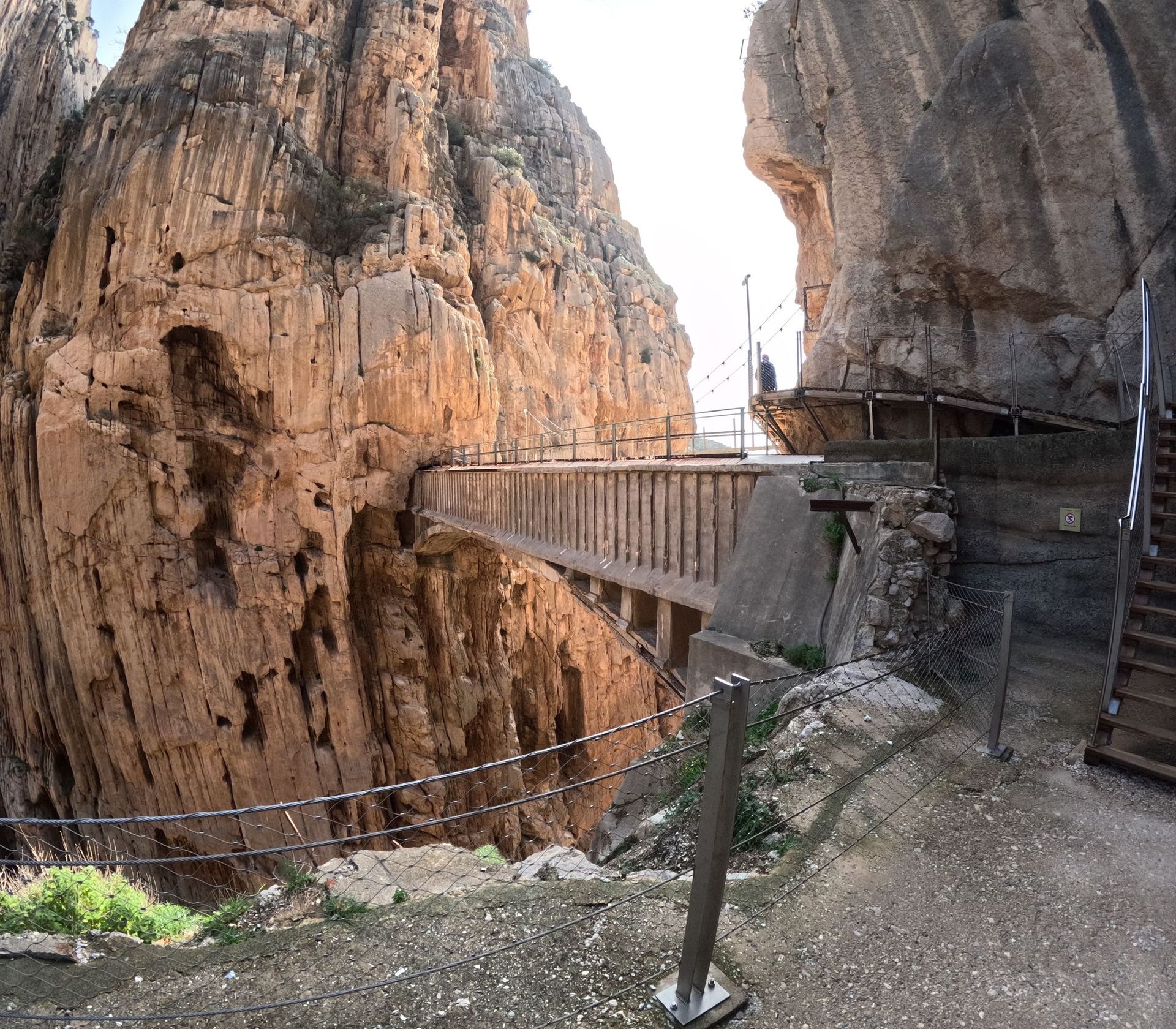
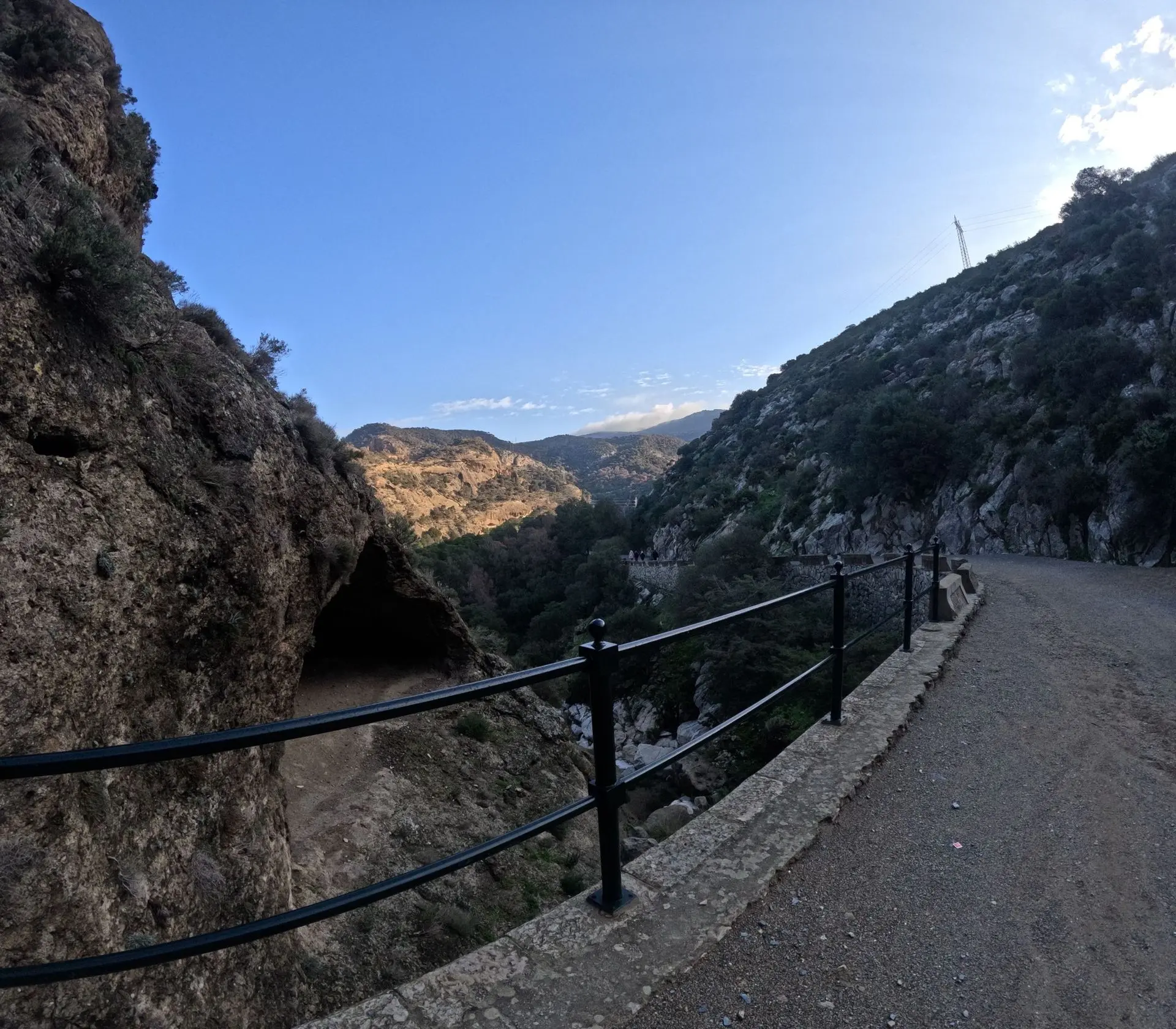
Caminito del Rey, or "The King's Path", is a picturesque walking route in Spain, running along the steep walls of the Desfiladero de los Gaitanes gorge, in the province of Málaga, Andalusia. It was built between 1901 and 1905 by a hydroelectric company to provide workers access to the El Chorro and Gaitanejo hydroelectric power stations.
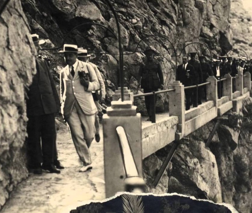
The name "Caminito del Rey" comes from the visit of King Alfonso XIII, who walked this route in 1921 during the inauguration of the Conde del Guadalhorce dam. King Alfonso XIII was enchanted by the beauty of the gorge and decided to walk the path, which gave it its current name.

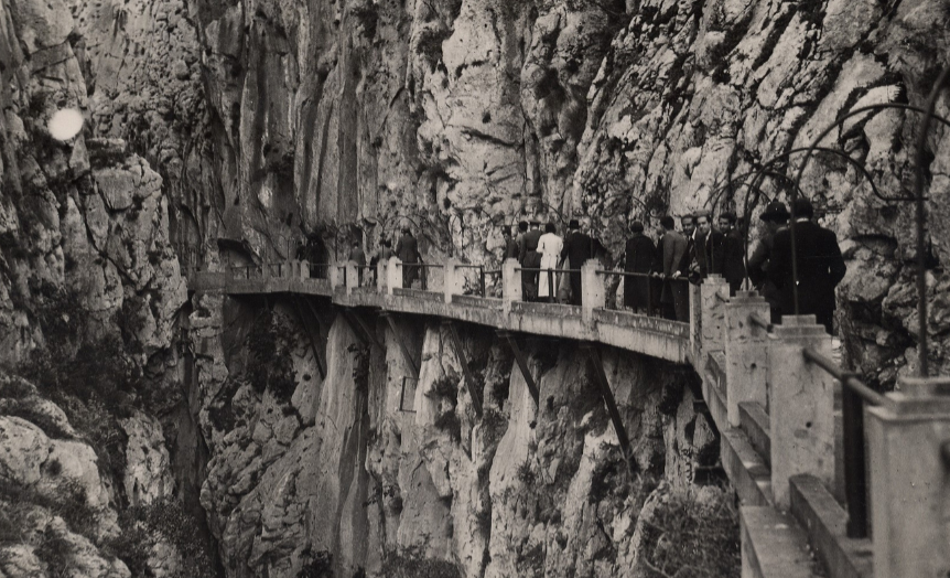
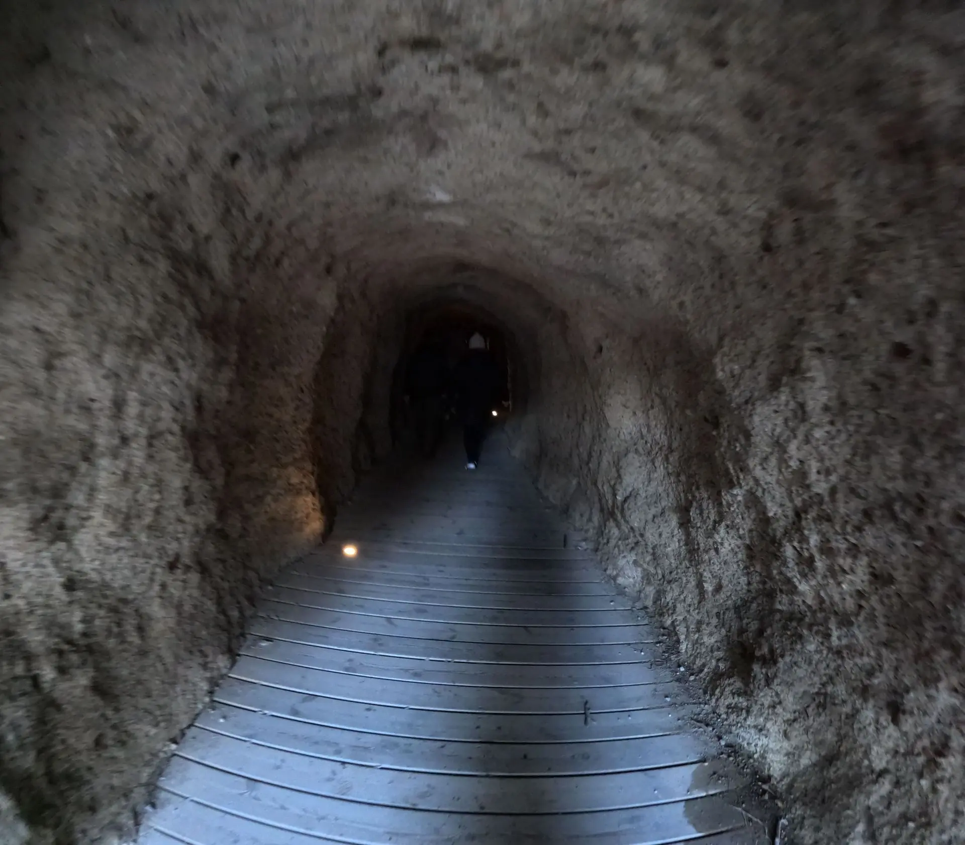
The path was originally built of concrete and rested on steel rails, but over the years it has suffered significant damage..
Between 1999 and 2000, several tragic accidents occurred, resulting in the deaths of five people. These accidents led to the closure of the path for over a decade. In 2014, renovation work began, which was completed in 2015, restoring the path for public use..
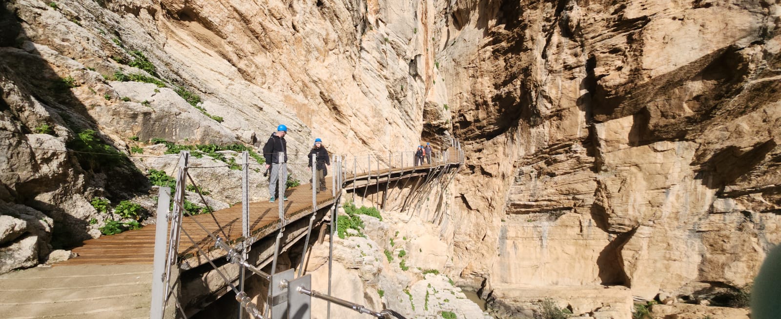
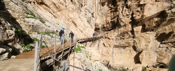
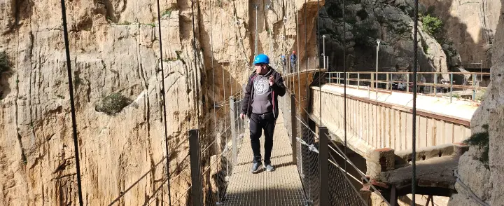
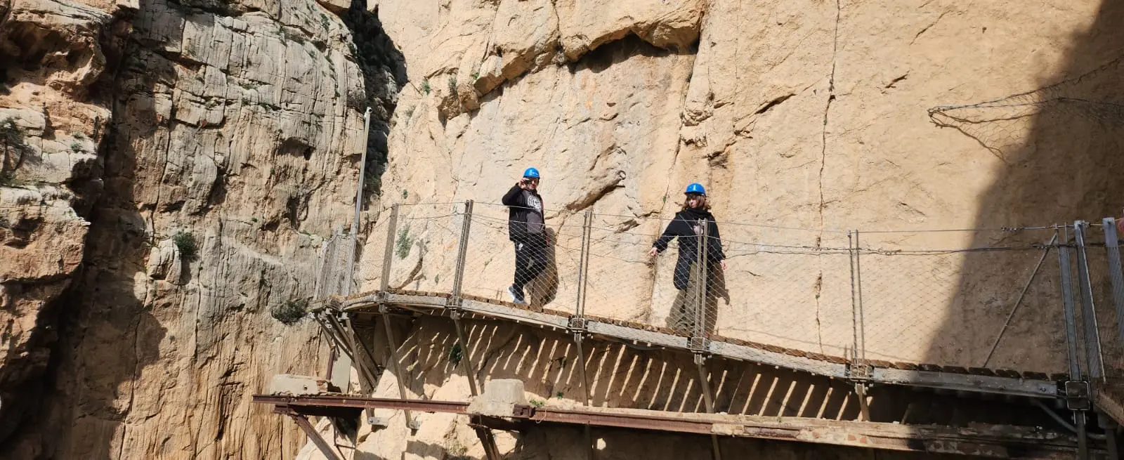
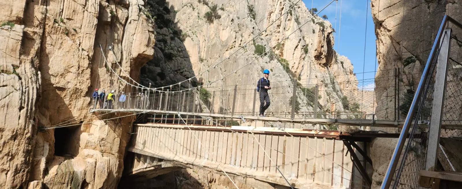
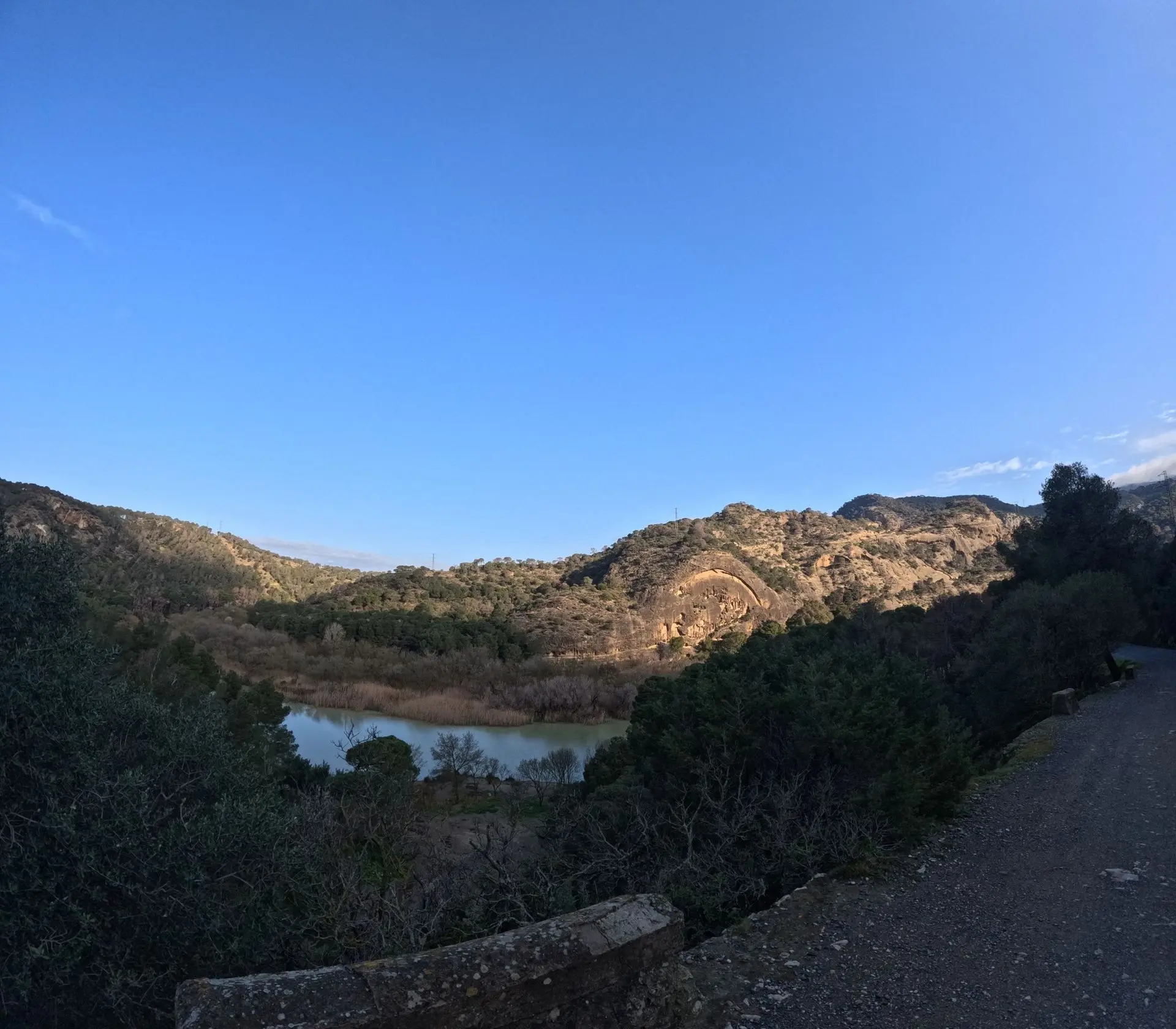
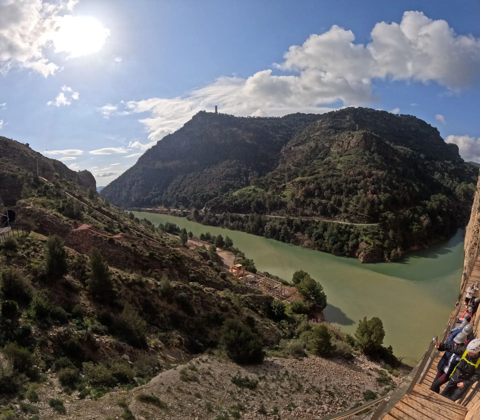
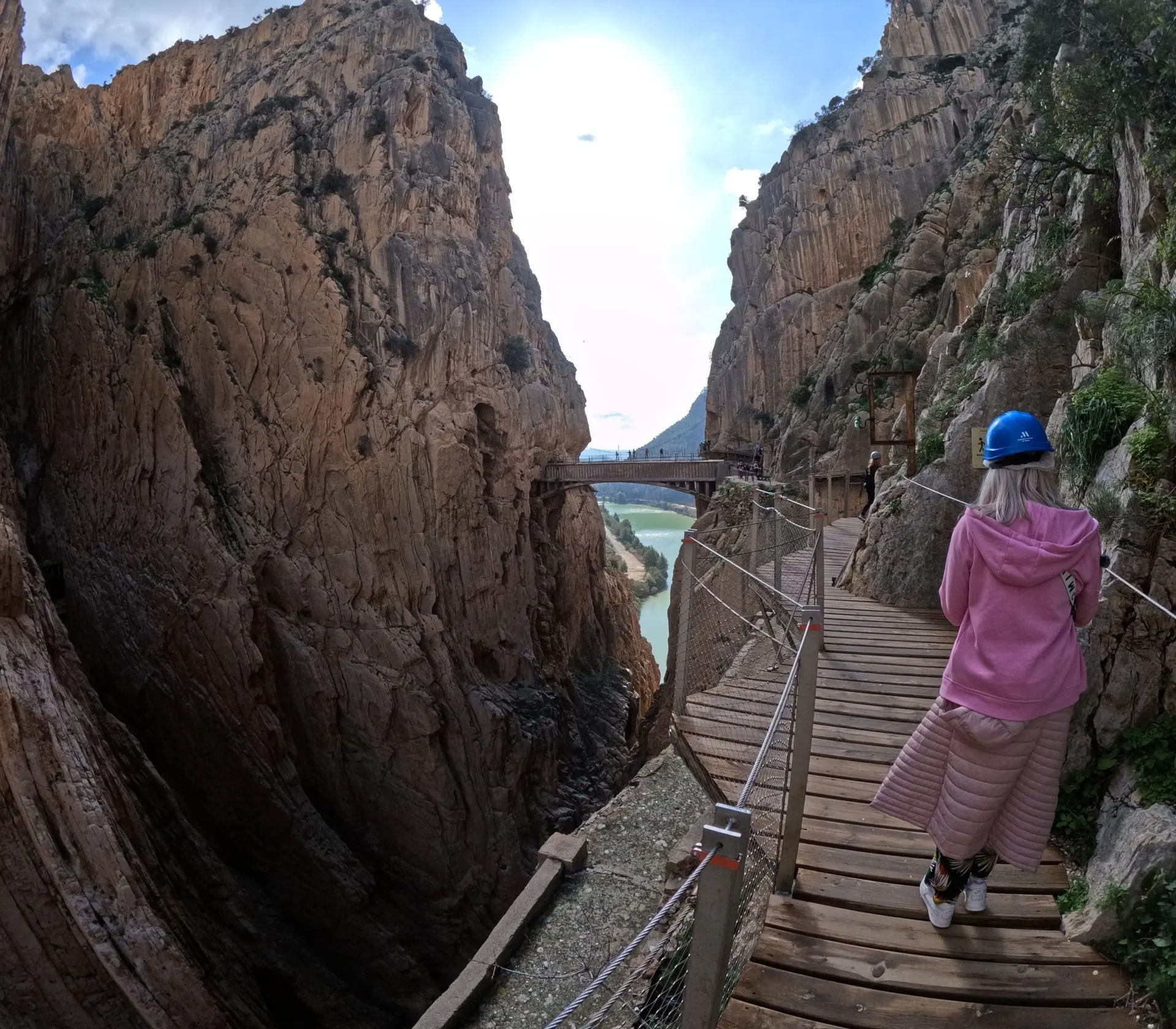
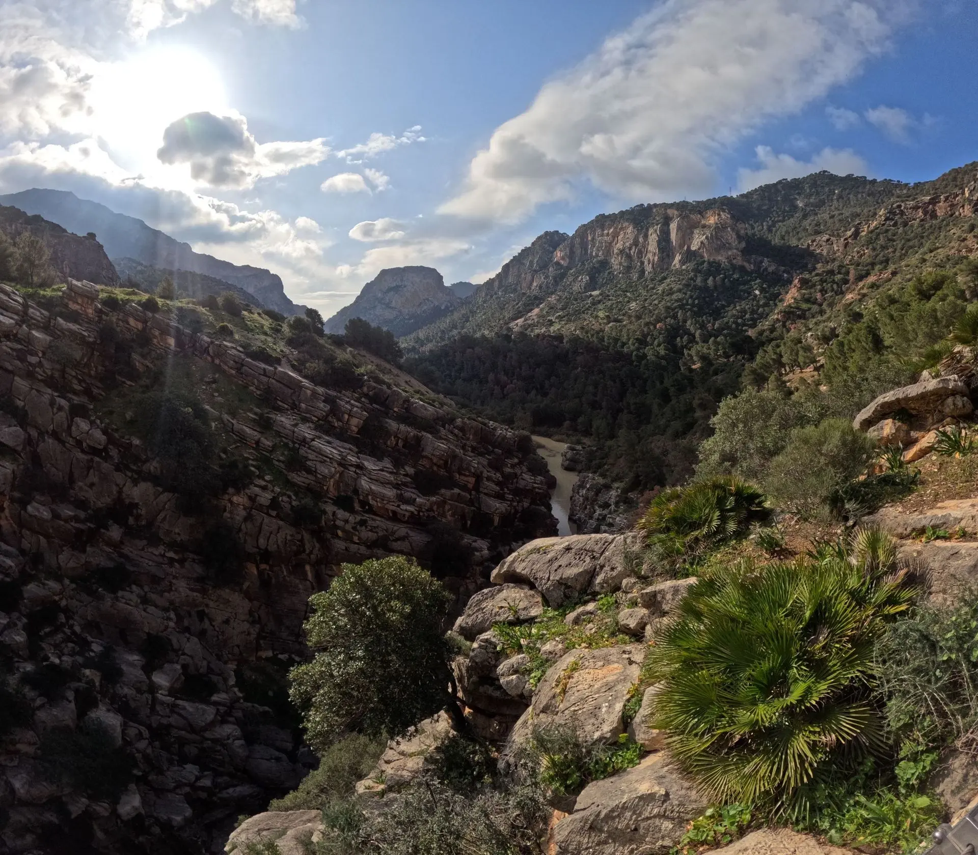
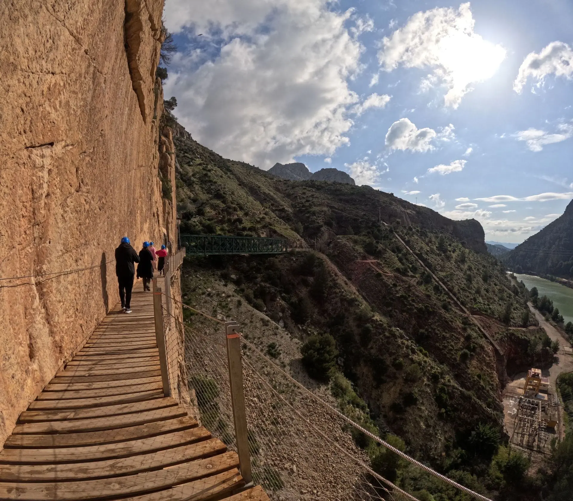
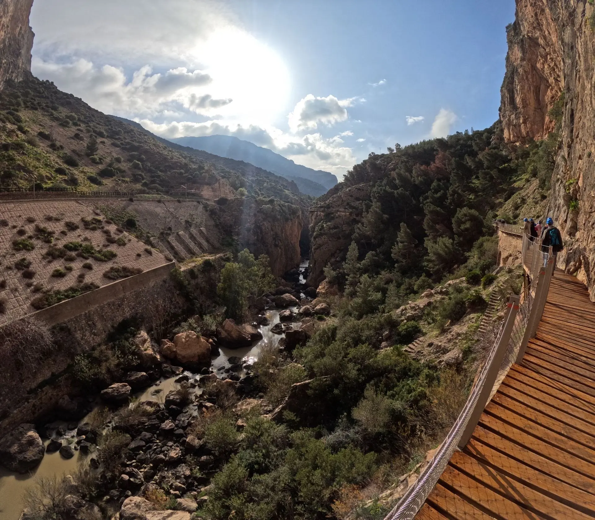
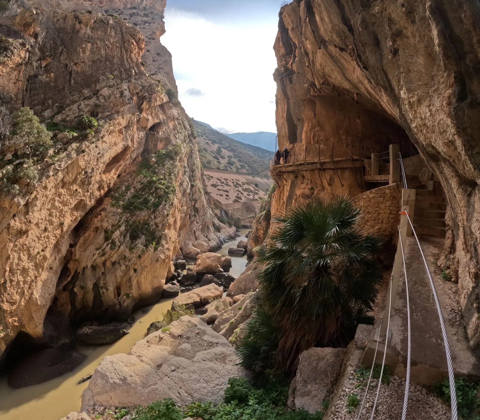
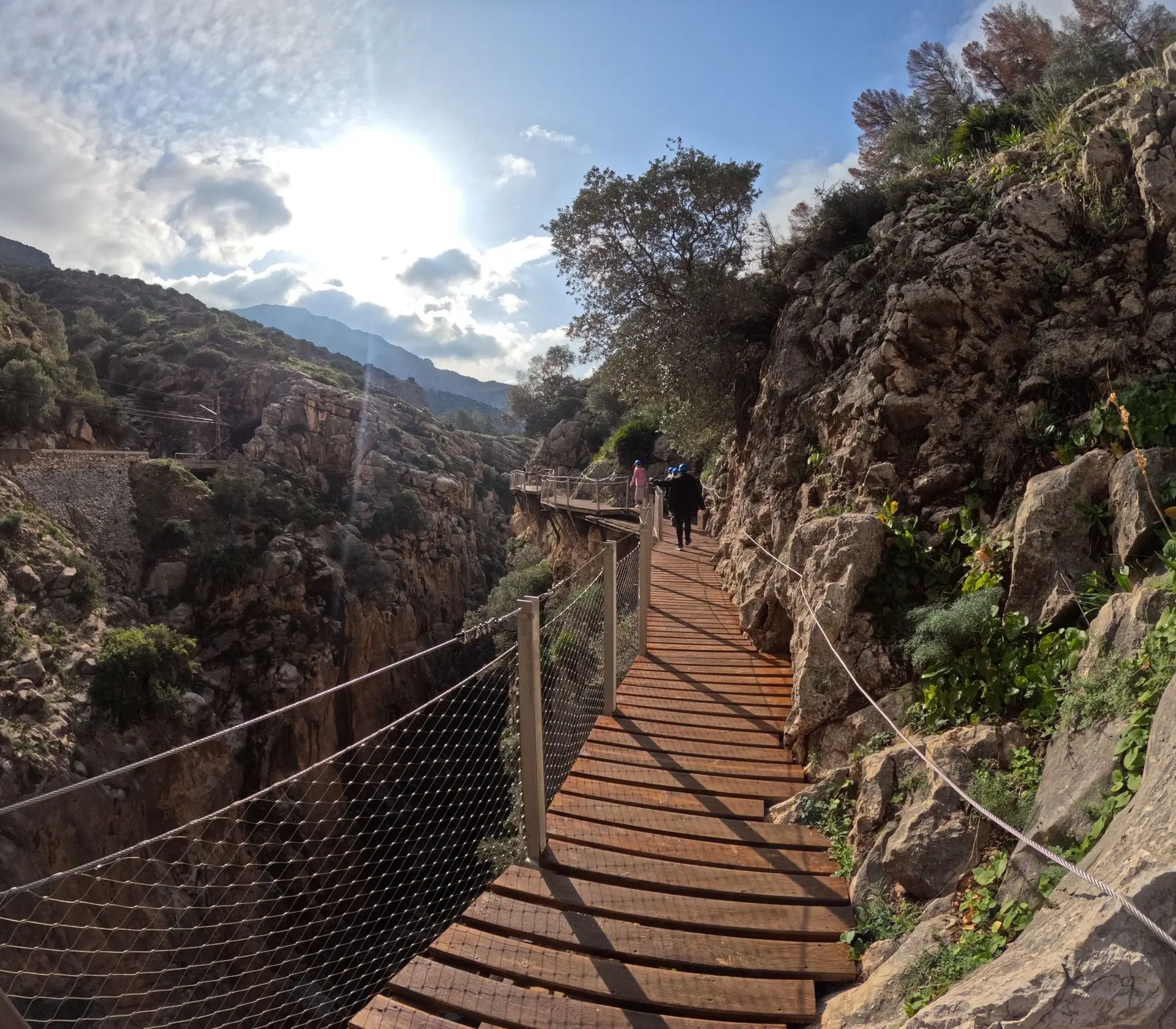
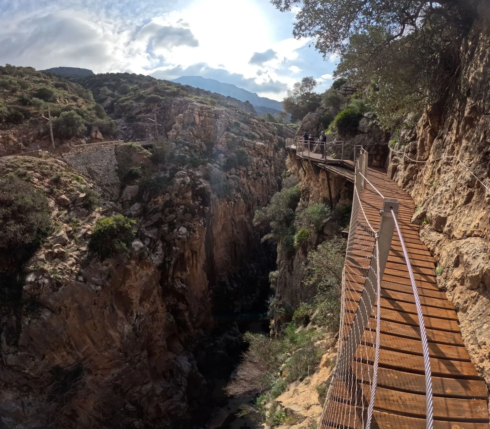
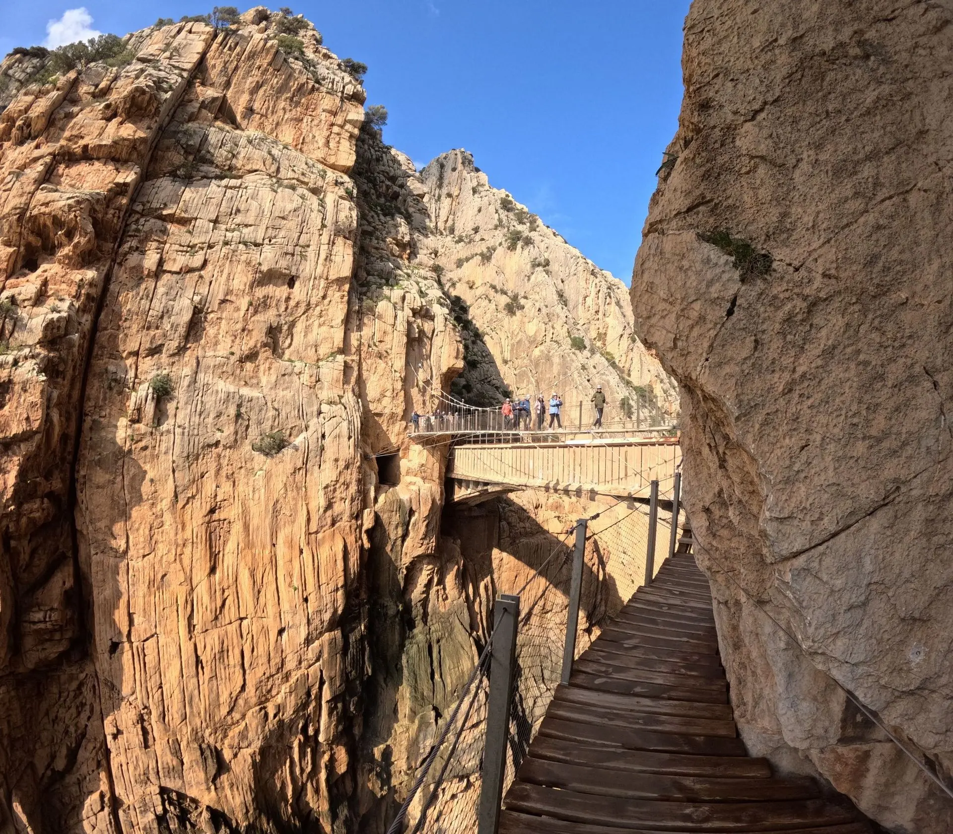
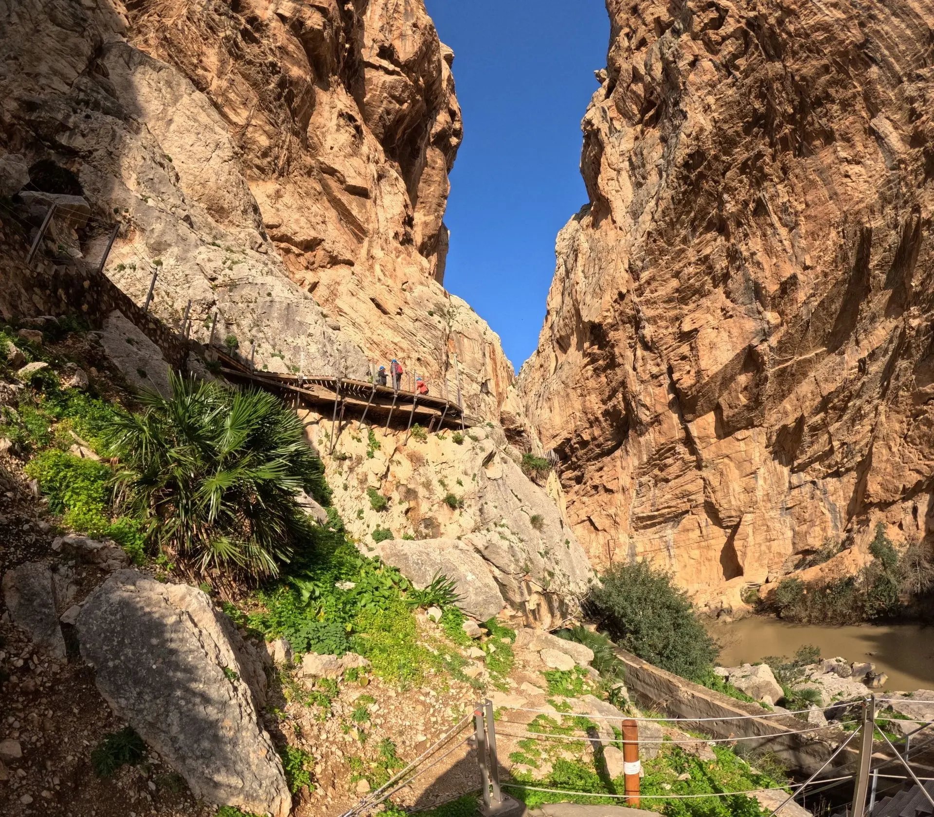
Currently, Caminito del Rey is much safer thanks to the new wooden walkways that have been built over the original route. The path is approximately 7.7 km long and offers spectacular views of the gorge and the Guadalhorce River. It is a popular tourist attraction, drawing around 300,000 visitors each year..

Caminito del Rey, despite its dark history, has become a symbol of the beauty and natural heritage of Spain. It is worth visiting to experience the thrill of walking one of the most picturesque hiking trails in the world..
And this is what Caminito looked like before the renovation:
Below you will see the entire, long film from our expedition!
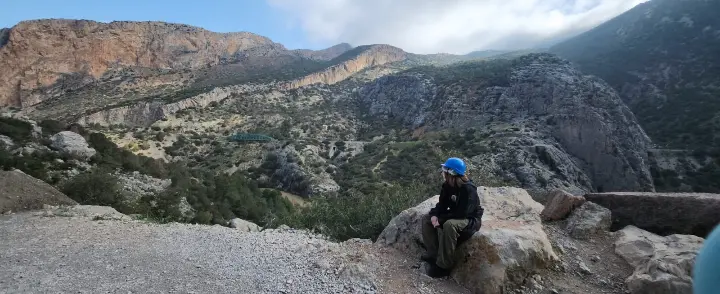
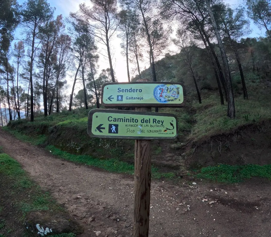
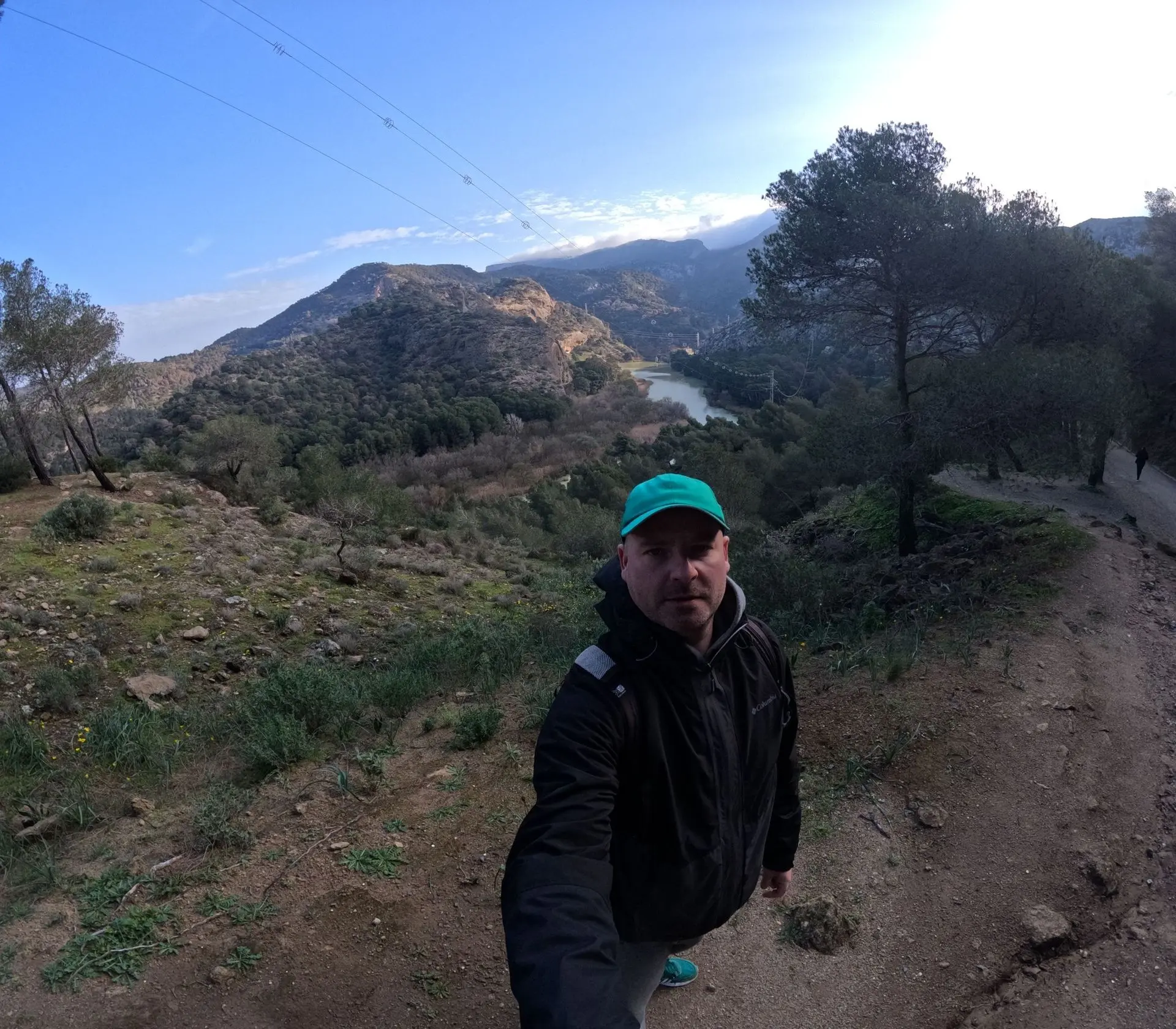
We started our adventure early in the morning.
We arrived at this car park: https://maps.app.goo.gl/jU12ryrSA11iZLHo6
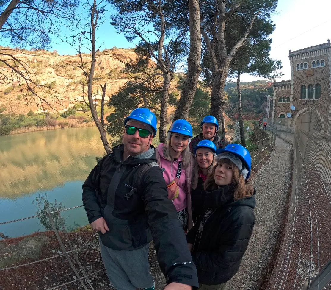
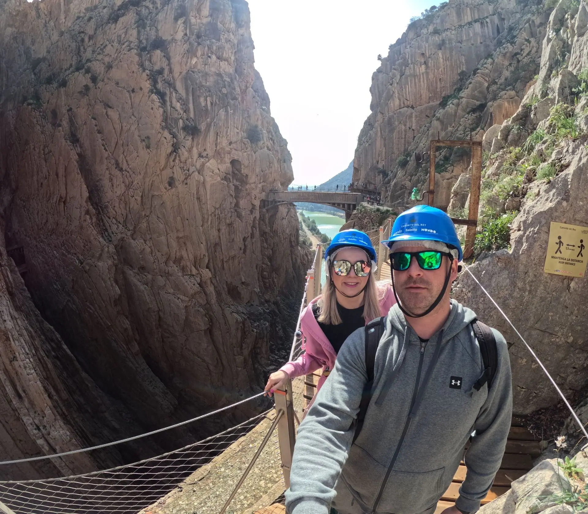
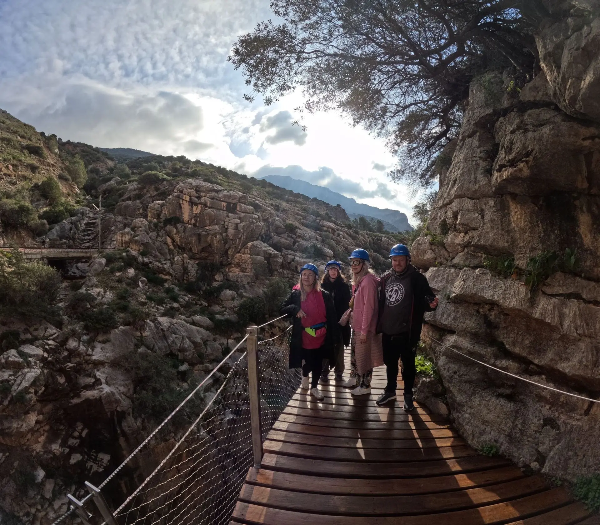
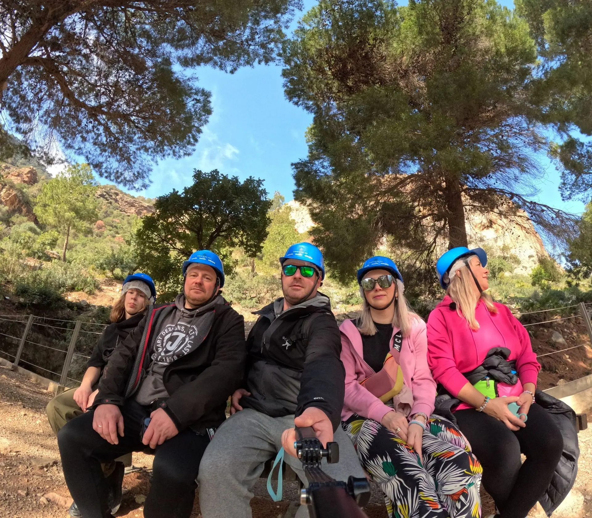
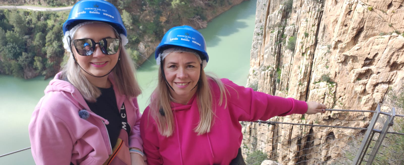
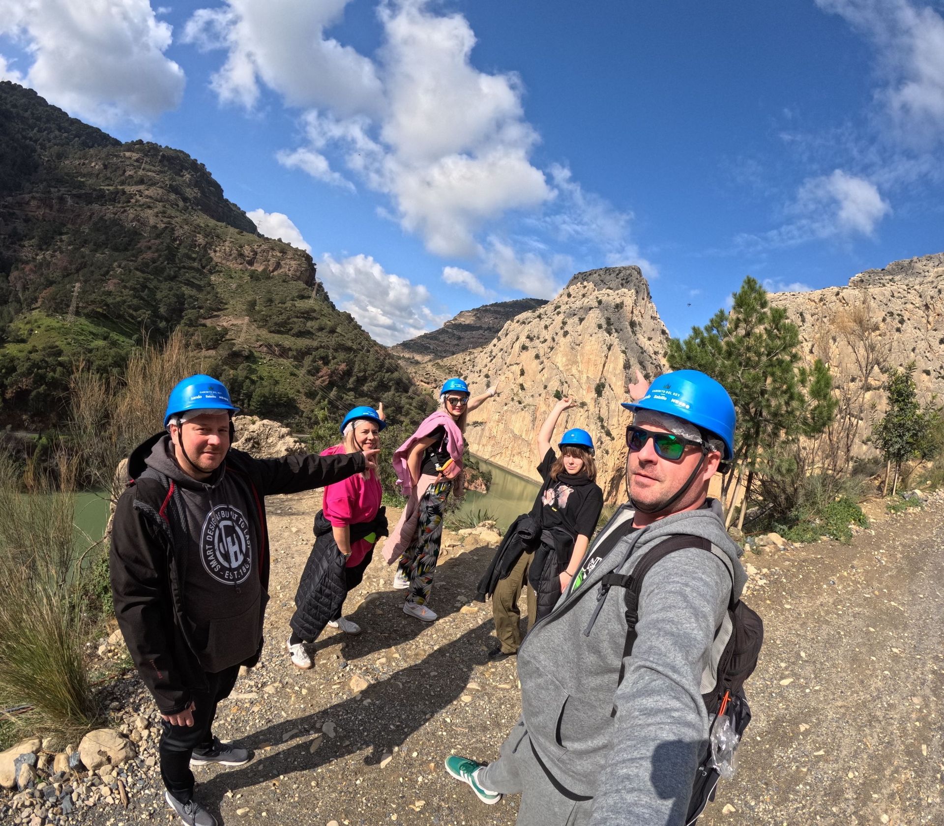
We left the car and took the bus to the starting point. After a brief visit to a local shop, we headed to the place where helmets are issued.
There is a lot of information online about how important it is to be on time... Well, that's not entirely true! We were over 45 minutes late and no one noticed. It's a shame we didn't know this earlier, as we wouldn't have had to rush so much! We received caps, helmets, a short training session, and we were able to enter the park area.

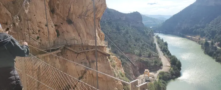
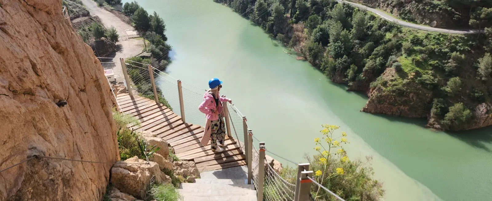
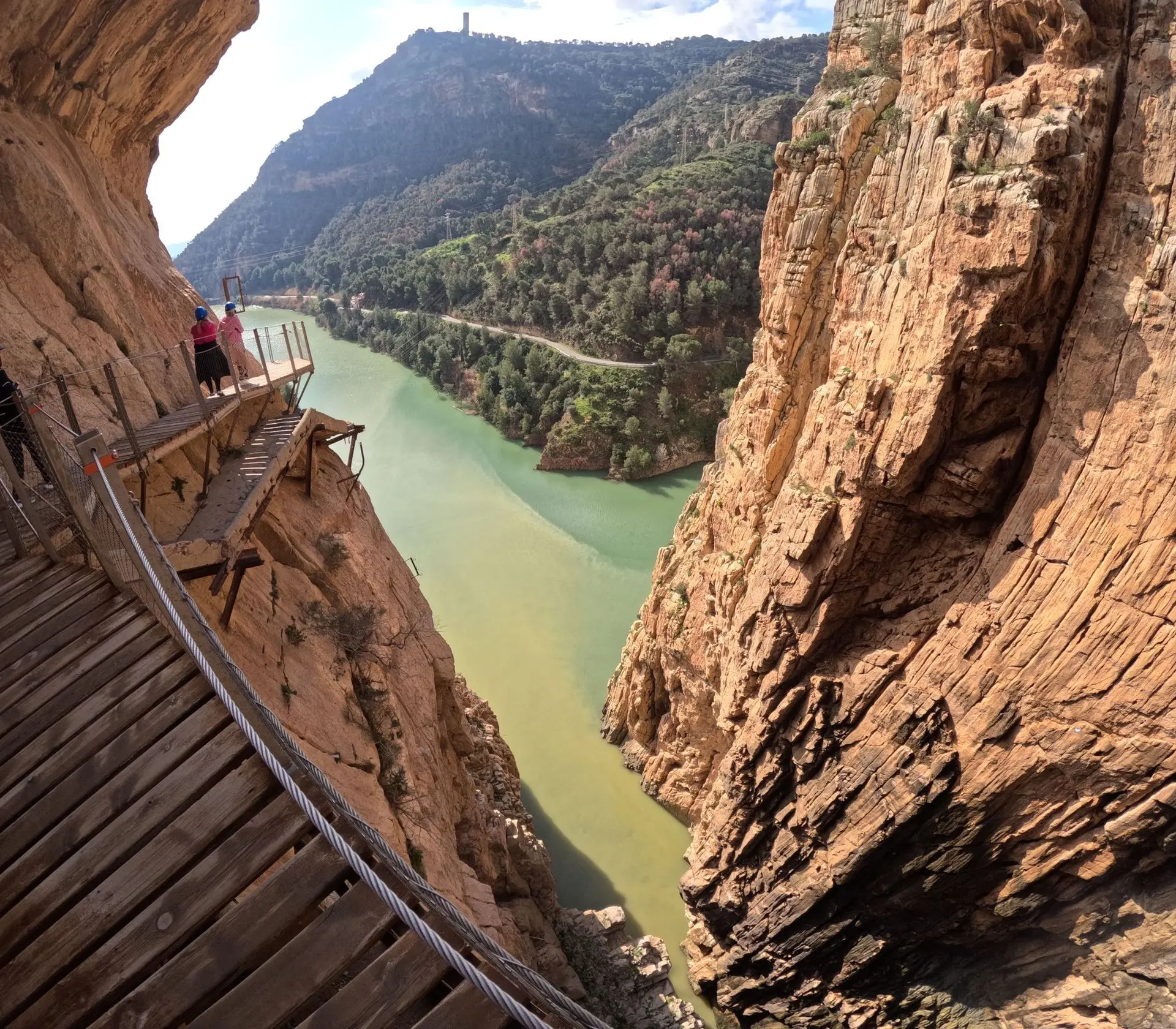
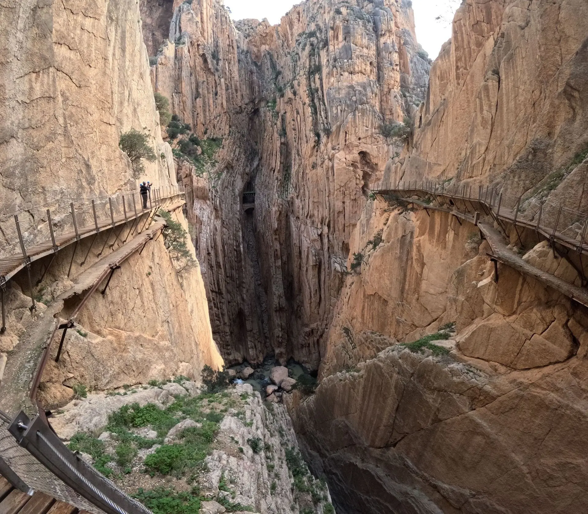
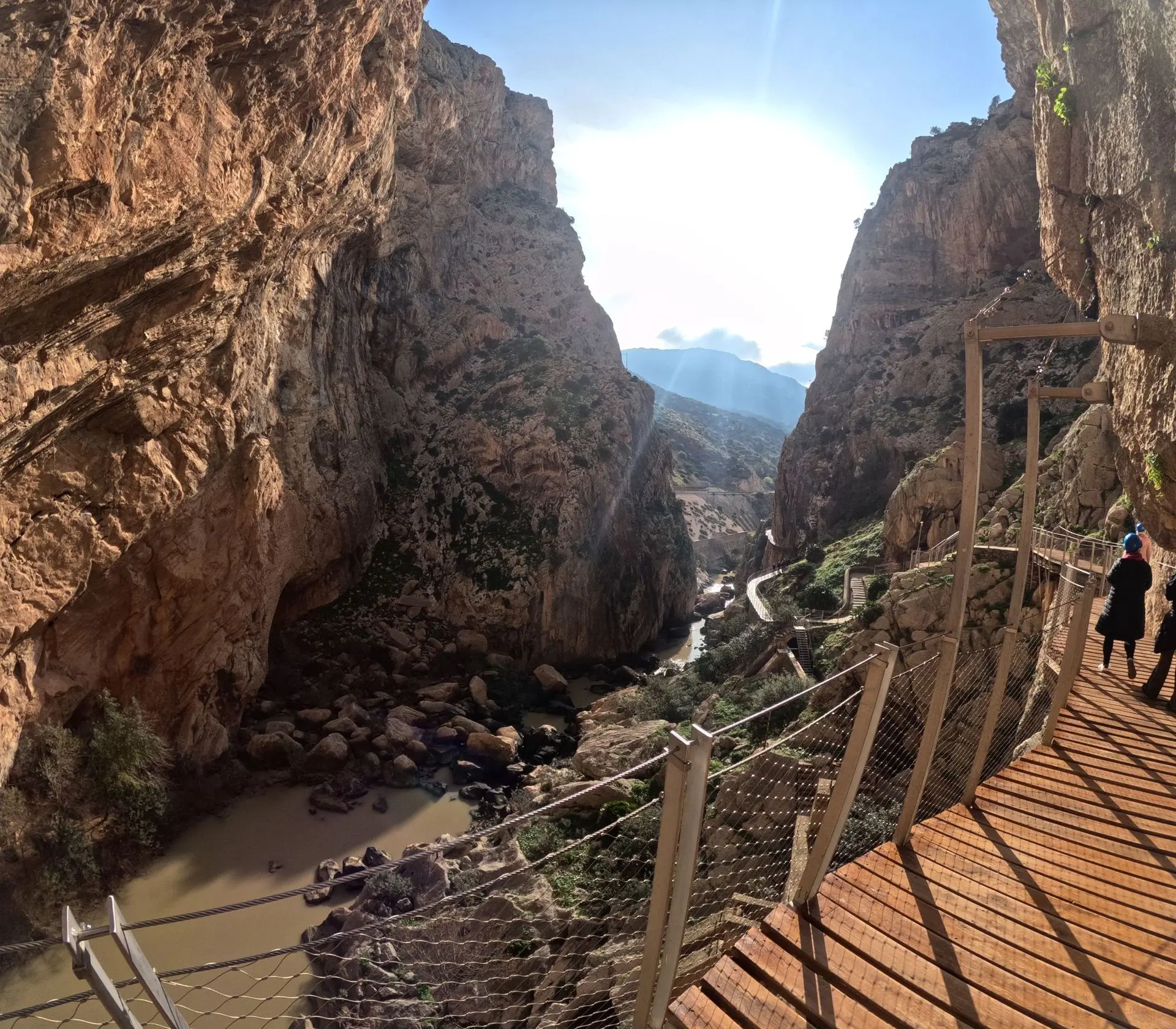
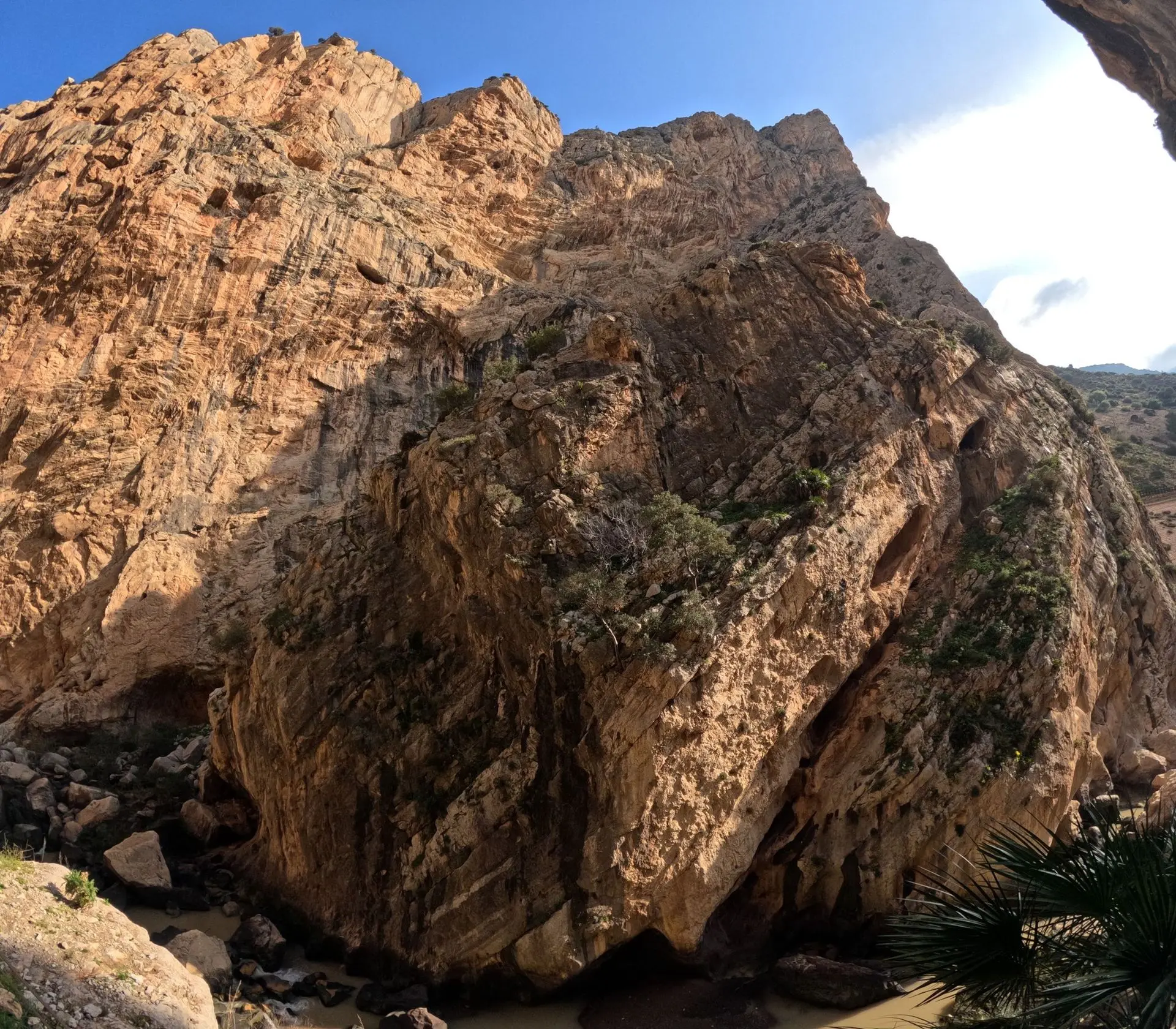
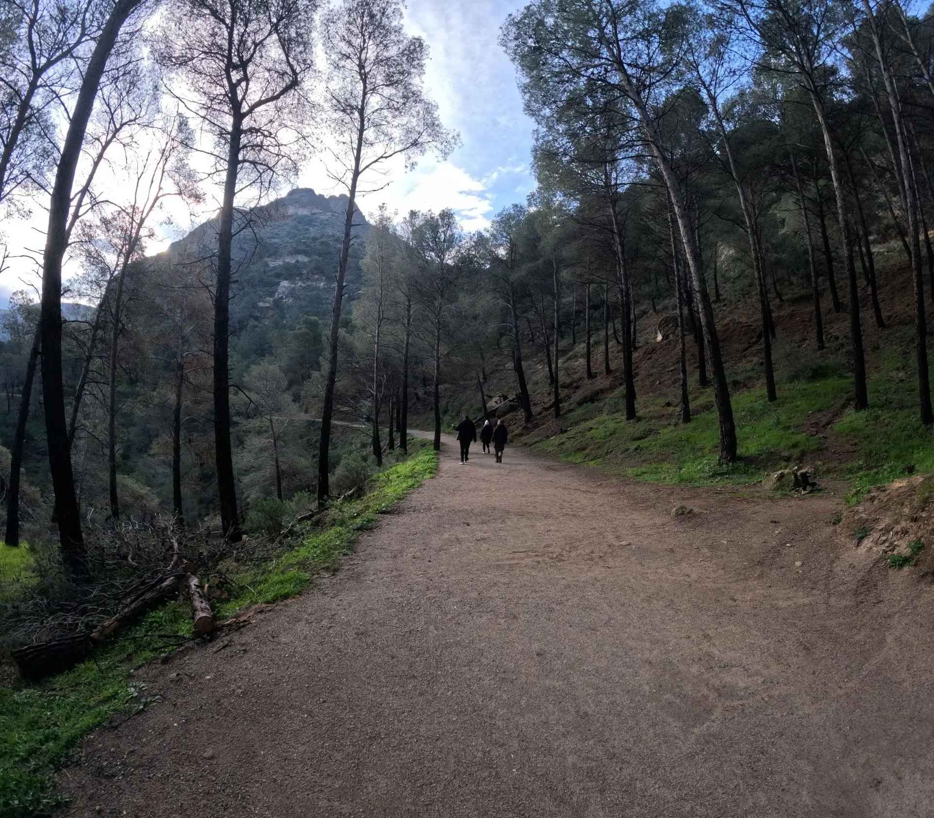
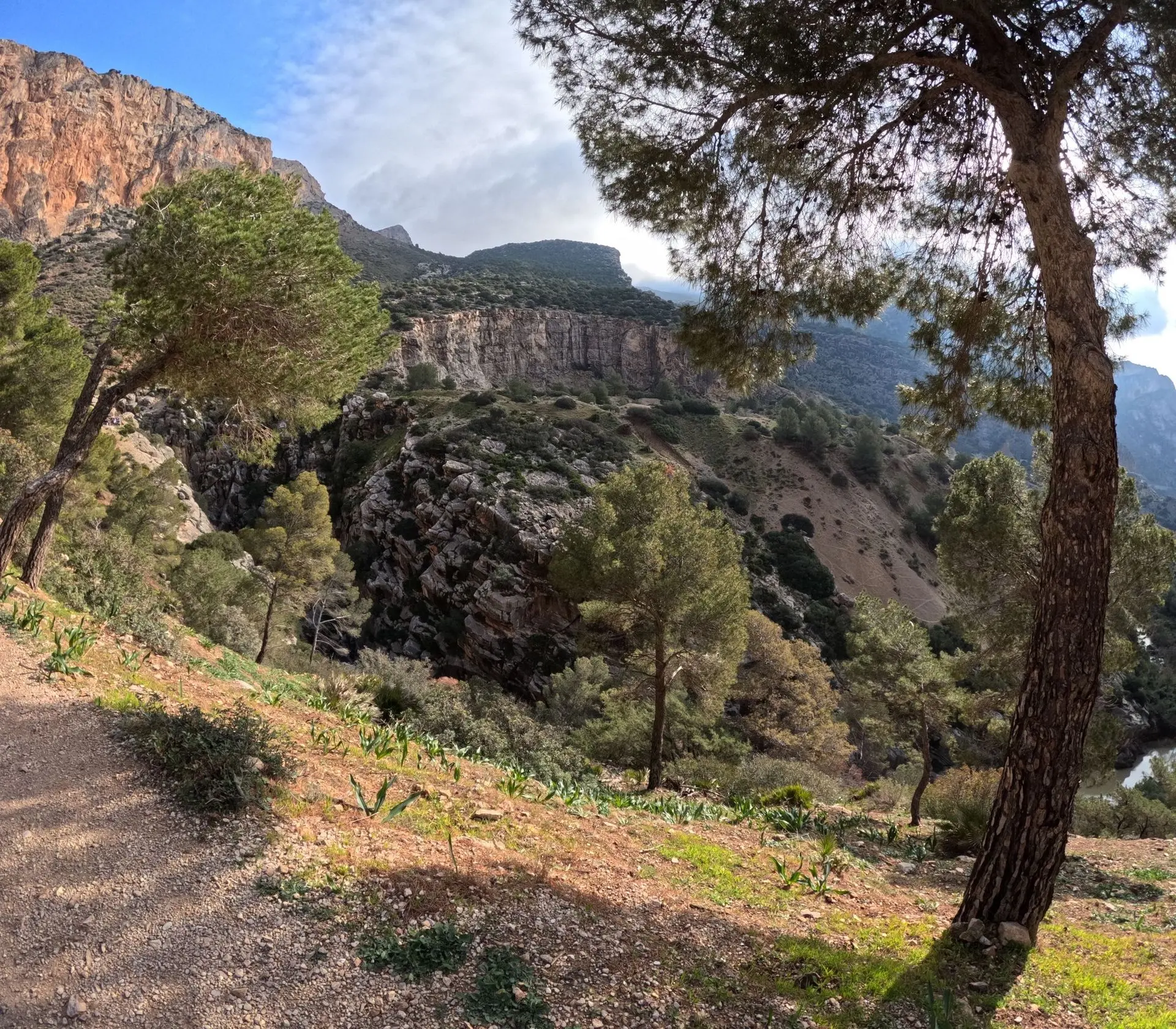
The views we had the pleasure of admiring are simply indescribable. To avoid stretching this page to 7.7 kilometres, I have placed the photos in a block format that can be browsed by clicking the arrows below the image.
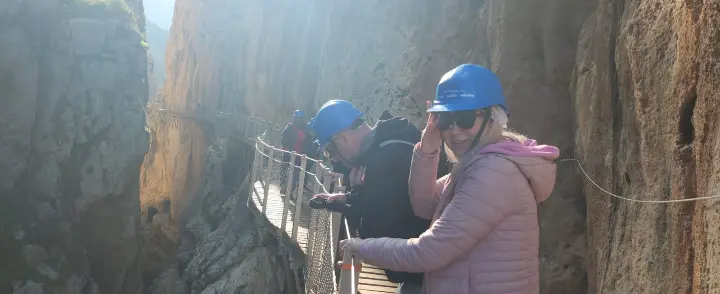
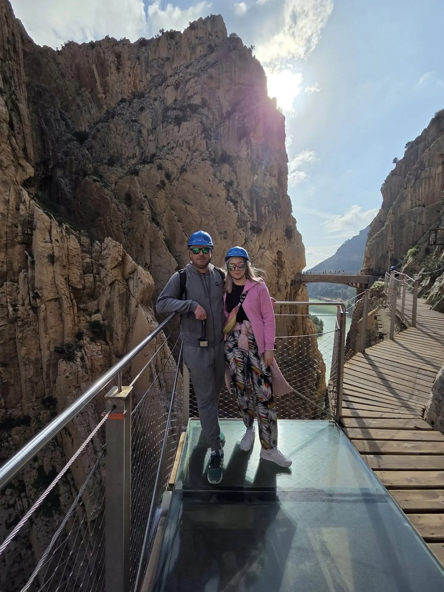
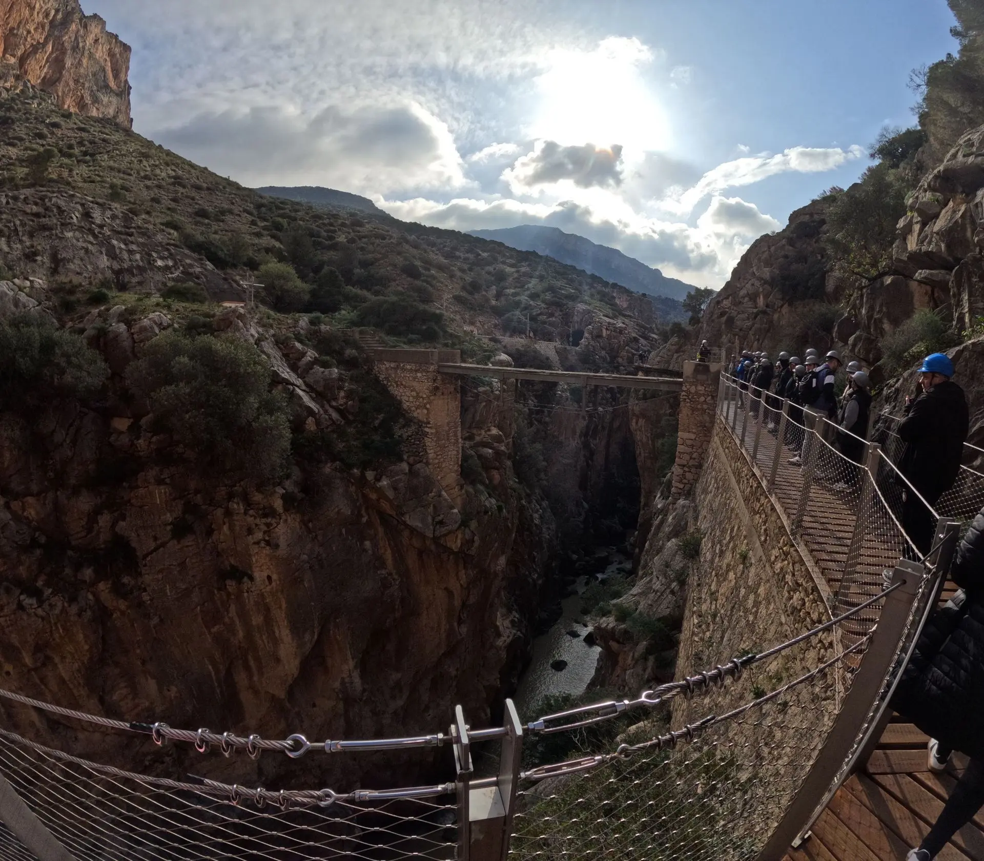
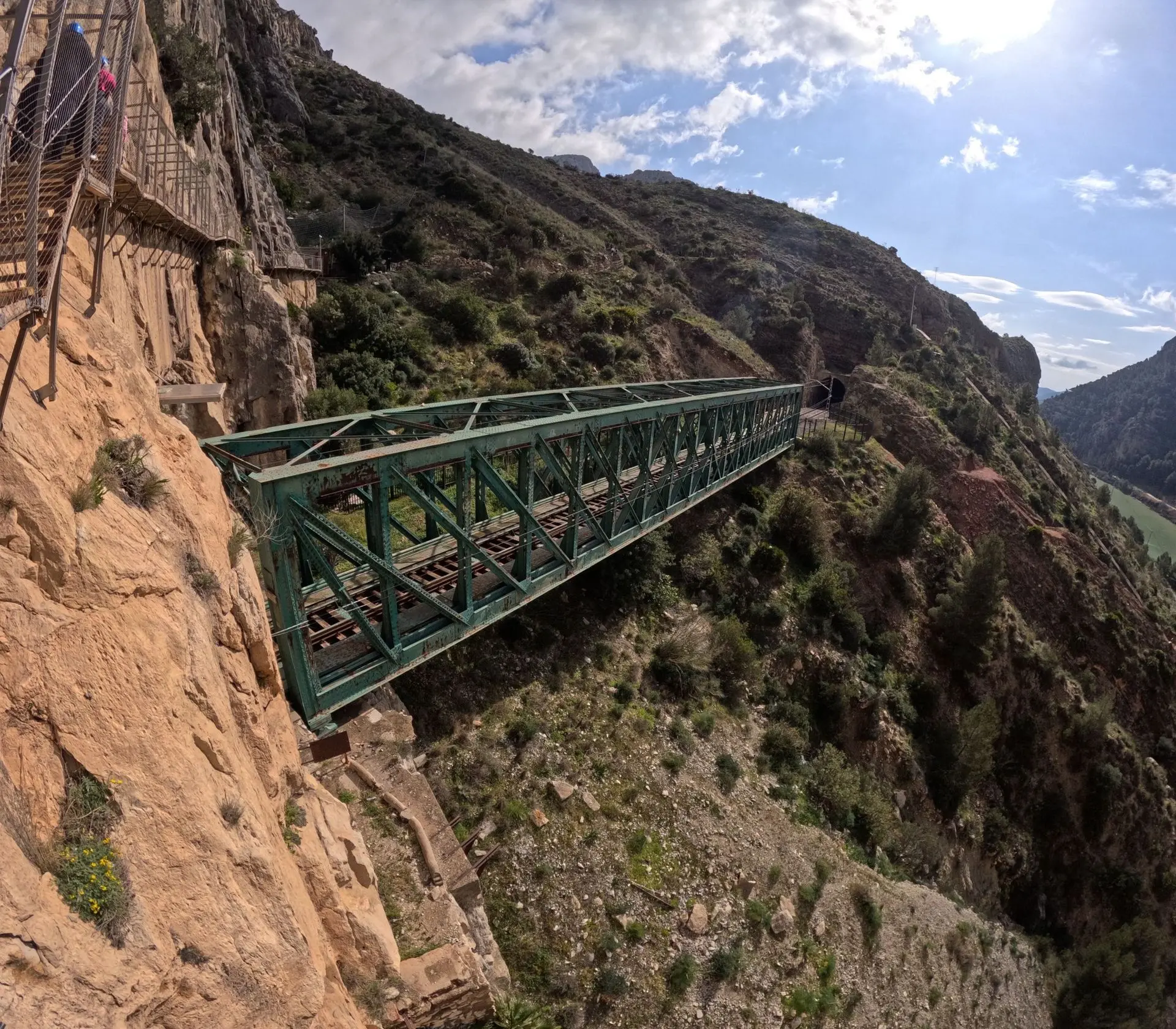
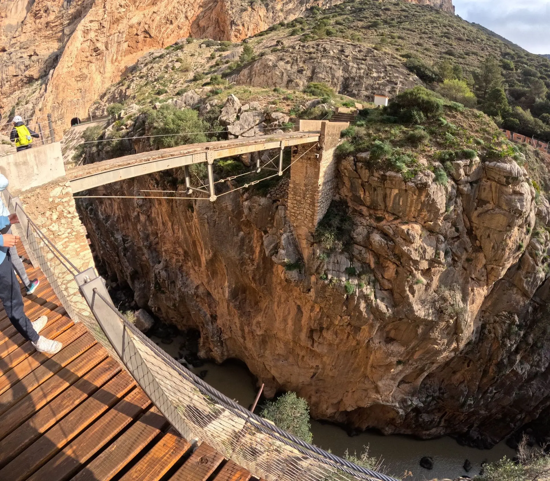
Just almost at the very end of the route, we crossed a picturesque bridge known as Puente Colgante. It is located at a height of about 100 metres above the valley of the Guadalhorce River.
In the gallery below, you will find over 40 photos taken by Kuba.


It took us 3.5 hours to complete the entire route.
Then we took another bus back to the car park.
The next stage of our trip was the picturesque town of Setenil, you can find more information here